
Source: Bureau of Meteorology
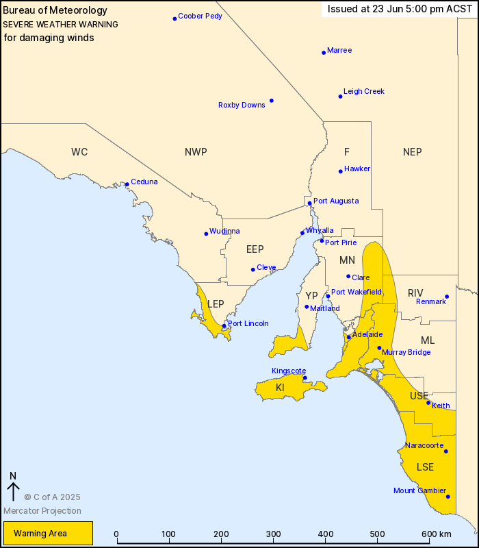
For people in Mount Lofty Ranges, Kangaroo Island, Upper South
East, Lower South East and parts of Adelaide Metropolitan, Lower
Eyre Peninsula, Yorke Peninsula, Mid North, Riverland, Murraylands
and North East Pastoral districts.
Issued at 5:00 pm Monday, 23 June 2025.
Damaging winds developing late tonight and continuing into
Tuesday.
Weather Situation: A complex low pressure system in the Bight is
extending a front over central South Australia, producing a
strengthening northwesterly flow ahead of it this evening. Another
cold front will then approach southern SA on Tuesday and the
pressure gradient will continue to strengthen, leading to vigorous
southwest to westerly flow with damaging wind gusts becoming more
widespread over ranges and exposed coasts.
Strong west to northwesterly winds with possible DAMAGING WIND
GUSTS of around 90 km/h are developing about southern Mount Lofty
Ranges in the evening, extending to coastal areas including
Adelaide Metro during Tuesday morning. Winds will become west to
southwesterly and possible DAMAGING WIND GUSTS in excess of 90 km/h
will extend to inland areas in the southeast and to the Flinders
Ranges during Tuesday afternoon.
Winds may drop below damaging thresholds during Tuesday evening,
before another burst of possible damaging wind gusts moves through
the southeast early Wednesday morning.
Winds are forecast to ease throughout the state by late Wednesday
morning.
A separate Coastal Hazard Warning for ABNORMALLY HIGH TIDES is
also current. Please refer to
http://www.bom.gov.au/sa/warnings/
Locations which may be affected include Adelaide, Mount Gambier,
Murray Bridge, Kingscote, Naracoorte and Keith.
The State Emergency Service advises that people should:
* Move vehicles under cover or away from trees;
* Secure or put away loose items around your property.
* Stay indoors, away from windows, while conditions are
severe.
23/Jun/2025 07:43 AM


