
Source: Bureau of Meteorology
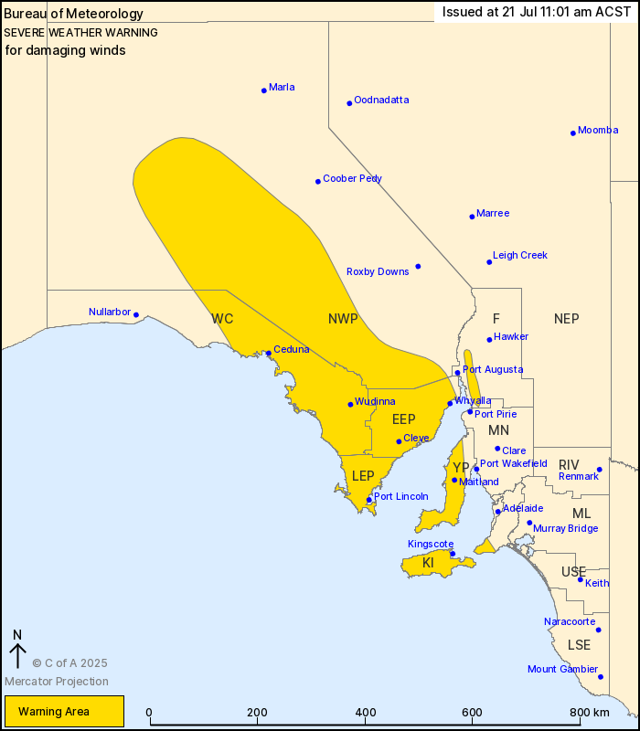
For people in West Coast, Lower Eyre Peninsula, Eastern Eyre
Peninsula, Yorke Peninsula, Kangaroo Island and parts of Mount
Lofty Ranges, Flinders and North West Pastoral districts.
Issued at 11:01 am Monday, 21 July 2025.
Possible damaging wind gusts increasing with the passage of a cold
front today.
Weather Situation: A cold front with vigorous northwesterly flow
ahead of it is currently near the western border. This is forecast
to cross the state during today and reach Ceduna by the
mid-afternoon, Port Lincoln by the early evening, and the Yorke
Peninsula by the late evening. Damaging wind gusts are possible
throughout the warning area during today.
Strong northwesterly winds averaging 50 to 60 km/h with DAMAGING
WIND GUSTS of around 100 km/h are possible from this morning over
parts of the Yorke Peninsula, Fleurieu Peninsula, Flinders Ranges,
Eyre Peninsula and Kangaroo Island. From around midday isolated
DAMAGING WIND GUSTS of around 90 km/h are also possible over inland
parts of the warning area, including the West Coast and North West
Pastoral districts.
Damaging wind gusts are forecast to ease below warning thresholds
over inland areas from sunset today, and over coastal areas later
this evening.
Locations which may be affected include Port Lincoln, Whyalla,
Ceduna, Maitland, Kingscote and Wudinna.
60-65 km/h sustained winds have been observed at Cleve from 1000
am to 1030 am.
The State Emergency Service advises that people should:
* Move vehicles under cover or away from trees;
* Secure or put away loose items around your property.
* Stay indoors, away from windows, while conditions are
severe.
21/Jul/2025 01:46 AM


