
Source: Bureau of Meteorology
Issued at 2:14 pm AEST on Friday 25 July 2025
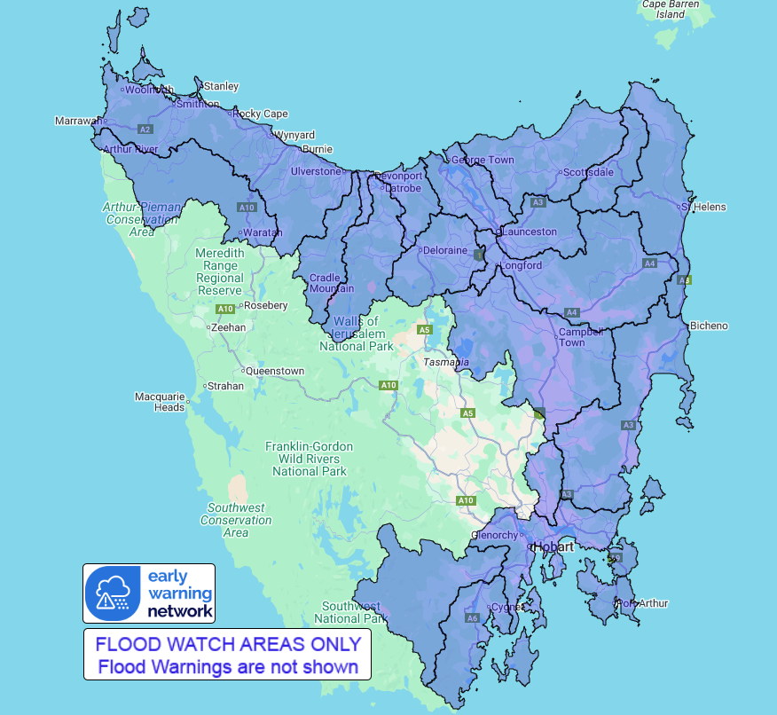
Flood Watch Number: 1
MINOR FLOODING LIKELY FROM SATURDAY AFTERNOON, WITH ISOLATED
MODERATE FLOODING POSSIBLE
A low over the southeast of the mainland is expected to approach
Tasmania from the northwest on Saturday and move to the south
during Sunday.
Moderate to possibly heavy rainfall is expected across the Flood
Watch area from Saturday morning through to Sunday, with the
highest rainfall totals expected at elevated locations.
Catchments across Tasmania are relatively wet following recent
rainfall, and catchments may react quickly to further
rainfall.
Rapid river, creek and rivulet rises are likely across the Flood
Watch Area from Saturday morning. Minor flooding is likely across
parts of Northern Tasmania from Saturday afternoon, with isolated
moderate flooding possible from Sunday morning.
Catchments likely to be affected include:
East Coastal Rivers (north of Bicheno)
East Coastal Rivers (south of Bicheno)
Coal River
South East
Huon River
Channel Coastal Rivers (South East Cape to Gordon)
Arthur River
Northwest and Central Coastal Rivers
Forth River
Mersey River
Meander River
Macquarie River
South Esk River
North Esk River
Tamar (Launceston)
Ringarooma River
North Coastal Rivers
For the latest flood and weather warnings see
http://www.bom.gov.au/australia/warnings
For the latest rainfall and river level information see
http://www.bom.gov.au/australia/flood
Safety Advice:
Don't drive, walk, swim or play in floodwater because it is
dangerous.
Stay away from flooded drains, rivers, streams and
waterways.
Obey road closure signs. Plan ahead so you don't drive on flooded
roads.
Check the ABC and local media for updates. The situation can
change quickly, so stay informed.
For local emergency management warnings and advice visit
www.alert.tas.gov.au.
For emergency assistance call SES on telephone number 132 500. In
life-threatening emergencies, call 000 (triple zero)
immediately.
Rainfall and River
Conditions Map
25/Jul/2025 04:30 AM


