
Source: Bureau of Meteorology
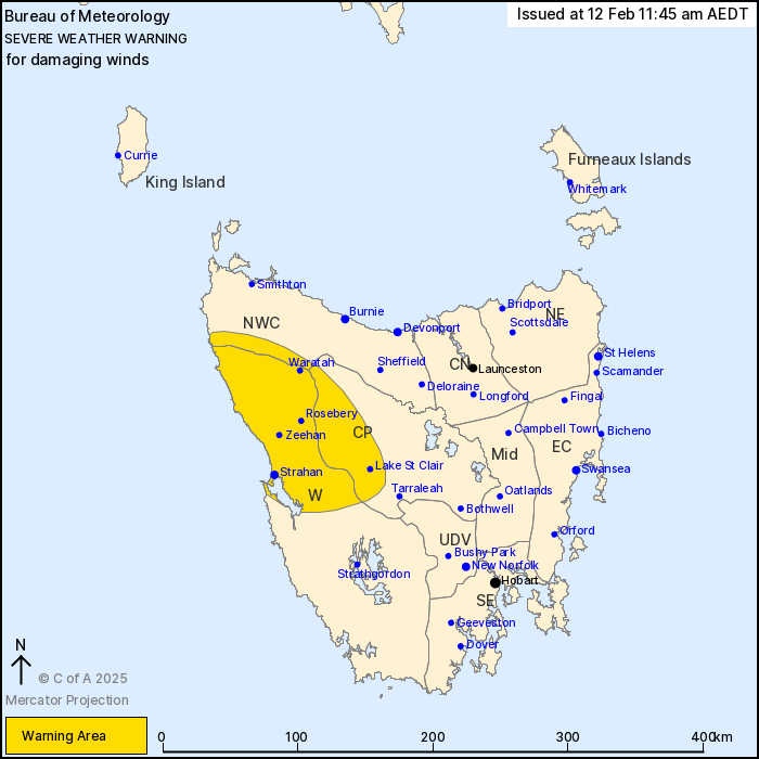
For people in parts of Western, North West Coast and Central
Plateau Forecast Districts.
Issued at 11:45 am Wednesday, 12 February 2025.
Damaging wind gusts from late this evening and into tomorrow
morning.
Weather Situation: Northeasterly winds will increase in strength
during the overnight period, ahead of an approaching cold front
forecast to move over the island Thursday evening. Damaging wind
gusts from the northeast are expected to occur over and in the lee
of elevated terrain as well as closer to the coast in the northwest
and west from late this evening, before easing by early Thursday
afternoon.
Northeasterly DAMAGING WIND GUSTS with peak gusts up to 90 km/h
are likely over parts of the North West Coast, Western and Central
Plateau districts from late this evening and continuing into
Thursday morning.
Winds are forecast to become more northerly and ease below warning
thresholds by early Thursday afternoon.
Locations which may be affected include Strahan, Queenstown,
Zeehan, Waratah, Rosebery and Lake St Clair.
The State Emergency Service advises that people should:
* Supervise children closely.
* Check that family and neighbours are aware of warnings.
* Manage pets and livestock.
* Secure outdoor items including furniture and play
equipment.
* Be prepared in case of power outages and report any outages to
TasNetworks on 132 004.
* Beware of damaged trees and power lines and take care when
driving.
* Listen to the ABC radio or check www.ses.tas.gov.au for further
advice.
* For emergency assistance contact the SES on 132500.
12/Feb/2025 12:54 AM


