
Source: Bureau of Meteorology
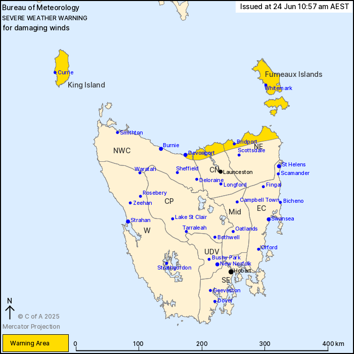
For people in King Island, Furneaux Islands and parts of North
East, Central North and North West Coast Forecast Districts.
Issued at 10:57 am Tuesday, 24 June 2025.
Damaging winds possible about parts of the northern exposed coast
and Islands today.
Weather Situation: A front, ahead of a complex low in the Bight,
is bringing increased winds as it moves through Bass Strait
today.
Strong northwesterly winds about 50 to 60 km/h with DAMAGING WIND
GUSTS around 100 km/h are possible as the frontal system traverses
from west to east through Bass Strait, especially in association
with showers or isolated thunderstorms.
King Island and central and eastern parts of the north coast may
be affected during the afternoon and evening; the far northeast
coast and Furneaux Islands this evening and early Wednesday.
Winds will shift west to southwesterly and abate in the wake of
the frontal system, though remain breezy during Wednesday.
Locations which may be affected include Devonport, Currie,
Whitemark, Bridport and George Town.
The State Emergency Service advises that people should:
* Supervise children closely.
* Check that family and neighbours are aware of warnings.
* Manage pets and livestock.
* Secure outdoor items including furniture and play
equipment.
* Be prepared in case of power outages and report any outages to
TasNetworks on 132 004.
* Beware of damaged trees and power lines and take care when
driving.
* Listen to the ABC radio or check www.ses.tas.gov.au for further
advice.
* For emergency assistance contact the SES on 132500.
24/Jun/2025 01:08 AM


