
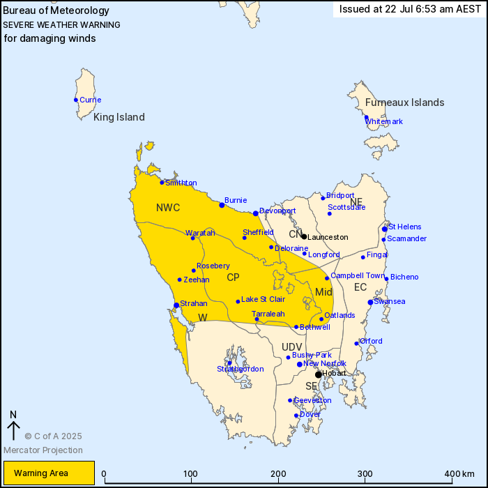
Source: Bureau of Meteorology
For people in North West Coast, Central Plateau and parts of
Western, Upper Derwent Valley, Central North and Midlands Forecast
Districts.
Issued at 6:53 am Tuesday, 22 July 2025.
Damaging winds likely for central and northwestern Tasmania
today.
A strong northerly flow ahead of an approaching cold front is
expected to produce damaging winds for central and northwestern
parts of the state from this morning until Wednesday morning. This
front will move over Tasmania tonight, clearing the state during
tomorrow.
DAMAGING WINDS with peak gusts of 110 km/h are possible for
central and broadly northwestern parts of Tasmania, including North
West Coast, Western, Central Plateau, Central North and Midlands.
Risk will persist throughout today, and ease below warning
thresholds by Wednesday morning.
Locations which may be affected include Devonport, Burnie,
Strahan, Smithton, Oatlands and Bothwell.
A 106 km/h gust was recorded at Mount Read at 06:11 am.
The State Emergency Service advises that people should:
* Supervise children closely.
* Check that family and neighbours are aware of warnings.
* Manage pets and livestock.
* Secure outdoor items including furniture and play
equipment.
* Be prepared in case of power outages and report any outages to
TasNetworks on 132 004.
* Beware of damaged trees and power lines and take care when
driving.
* Listen to the ABC radio or check www.ses.tas.gov.au for further
advice.
* For emergency assistance contact the SES on 132500.
21/Jul/2025 09:13 PM


