
Source: Bureau of Meteorology
Issued at 2:30 pm EST on Friday 19 July 2024
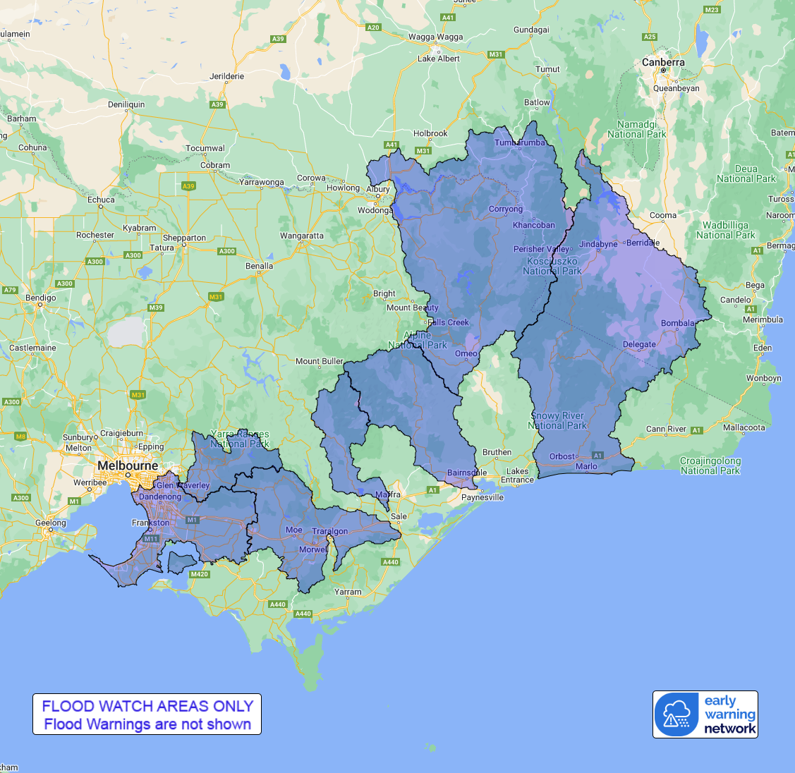
Flood Watch Number: 1
MINOR FLOODING POSSIBLE FROM SATURDAY MORNING, WITH CHANCE OF
ISOLATED MODERATE FLOODING
A cold front approaching from the west will bring scattered
showers and patchy rain to the Flood Watch area from late Friday.
Showers and rain areas are largely expected to clear the Flood
Watch area by Sunday.
Catchments in the Flood Watch area are relatively wet.
Rainfall totals of 30 to 50 mm are likely from late Friday across
the Flood Watch area. Higher rainfall totals are likely over the
higher ground, with snow in places.
River level rises and minor flooding may develop across the Flood
Watch area from Saturday morning. There is a chance of isolated
moderate flooding in the Macalister, Upper Murray, Upper Yarra, and
Bunyip River catchments, and the Dandenong Creek catchment.
Catchments likely to be affected include:
Snowy River
Mitchell River
Macalister River
Latrobe River(Minor flood warning current)
Bunyip River and Dandenong Creek(Minor flood warning current for
Bunyip River)
Yarra River to Coldstream(Minor flood warning current for Yarra
River)
Upper Murray and Mitta Mitta Rivers
The Bureau of Meteorology is continuing to monitor the situation
and will issue catchment specific warnings as required.
See www.bom.gov.au/vic/warnings to view the current warnings for
Victoria.
For more information on the Flood Watch Service:
http://www.bom.gov.au/water/floods/floodWarningServices.shtml
Flood Safety Advice:
Note: This Flood Watch means that people living or working along
rivers and streams must monitor the latest weather forecasts and
warnings and be ready to move to higher ground should flooding
develop.
SES advises that all community members should:
Never walk, ride or drive through floodwater, Never allow children
to play in floodwater, Stay away from waterways and stormwater
drains during and after heavy rain, Keep well clear of fallen power
lines Be aware that in fire affected areas, rainfall run-off into
waterways may contain debris such as ash, soil, trees and rocks,
and heavy rainfall increases the potential for landslides and
debris across roads.
Current Emergency Information is available at
http://emergency.vic.gov.au For emergency assistance contact the
SES on 132 500.
Current Road and Traffic Information is available at the VicRoads
website:
http://traffic.vicroads.vic.gov.au/
Weather Forecast:
For the latest weather forecast see
http://www.bom.gov.au/vic/forecasts/
River Height and Rainfall information are available on the Bureau
of Meteorology web site at http://www.bom.gov.au/vic/flood/
Flood Warnings and Flood Watches for Victorian Catchments are also
available on: Telephone Weather Service No. 1300 659217.
Rainfall and River
Conditions Map
19/Jul/2024 04:45 AM

