
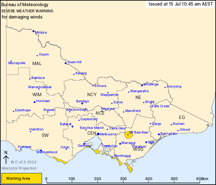
Source: Bureau of Meteorology
For people in parts of West and South Gippsland, Central and South
West Forecast Districts.
Issued at 10:45 am Monday, 15 July 2024.
Damaging winds developing developing this afternoon along parts of
the southwest facing southern coasts and Mt Baw Baw, with blizzard
conditions also possible for Mt Baw Baw.
Weather Situation: A complex low pressure system currently lies to
the east of Tasmania. This low is forecast to track towards the
Bass Strait during the day today, with a series of associated
troughs crossing Victoria, resulting in strengthening southwesterly
winds along parts of the coastline and Mt Baw Baw.
For parts of the SOUTHWEST FACING SOUTHERN COASTS: DAMAGING WINDS
averaging 60 to 70 km/h with peak gusts of around 90 km/h are
possible for parts of the coastal fringe extending from Port
Campbell to Wilsons Promontory from late this afternoon, easing
overnight tonight.
For MT BAW BAW: Strong winds averaging 55 to 65 km/h with DAMAGING
WIND GUSTS of around 90 km/h, along with BLIZZARD conditions above
1200m are possible from early this afternoon, easing overnight
tonight.
Locations which may be affected include Wonthaggi, Rosebud, Tidal
River and Mt Baw Baw.
The State Emergency Service advises that people should:
* If driving conditions are dangerous, safely pull over away from
trees, drains, low-lying areas and floodwater. Avoid travel if
possible.
* Stay safe by avoiding dangerous hazards, such as floodwater,
mud, debris, damaged roads and fallen trees.
* Be aware - heat, fire or recent storms may make trees unstable
and more likely to fall when it's windy or wet.
* Check that loose items, such as outdoor settings, umbrellas and
trampolines are safely secured. Move vehicles under cover or away
from trees.
* Stay indoors and away from windows.
* If outdoors, move to a safe place indoors. Stay away from trees,
drains, gutters, creeks and waterways.
* Stay away from fallen powerlines - always assume they are
live.
* Be aware that in fire affected areas, rainfall run-off into
waterways may contain debris such as ash, soil, trees and rocks.
Heavy rainfall may also increase the potential for landslides and
debris across roads.
* Stay informed: Monitor weather warnings, forecasts and river
levels at the Bureau of Meteorology website, and warnings through
VicEmergency website/app/hotline.
15/Jul/2024 12:59 AM

