
Source: Bureau of Meteorology
Issued at 10:57 am AWST on Saturday 7 February 2026
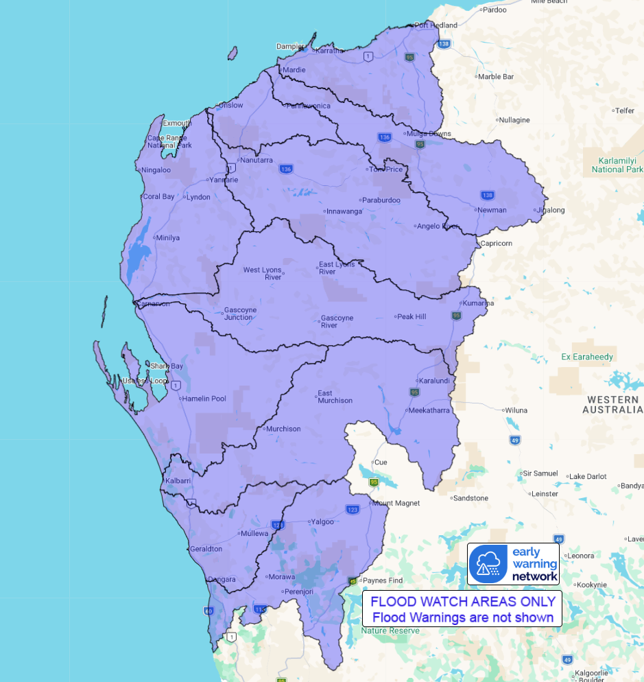
Flood Watch Number: 6
FLOODING MAY DEVELOP ACROSS THE FLOOD WATCH AREA OVER THE WEEKEND
AND INTO MONDAY
Tropical Cyclone Mitchell is currently located offshore, moving
parallel to the Pilbara coast. It is expected to maintain this
trajectory through late Sunday, with the potential to make landfall
in the western Pilbara between Sunday night and Monday. This system
is expected to bring widespread rainfall, with heavy falls possible
along the Pilbara coast from late Saturday into Sunday, and
extending into the western Gascoyne-Murchison from Sunday into
Monday. Uncertainties remain regarding the movement of the tropical
cyclone and the exact areas that will receive the heaviest
rainfall.
River level rises, localised flooding, and overland inundation are
possible in parts of the Flood Watch area, which may affect road
access. Some communities may become isolated. Check road conditions
before travelling.
Catchments likely to be affected include:
Yarra Yarra Lakes District
Greenough River
Murchison River
Wooramel River
Gascoyne River
Lyndon-Minilya Rivers
Ashburton River
Onslow Coast
Fortescue River
Pilbara Coastal Rivers
Flooding is no longer expected in the following catchment(s):
Fitzroy and West Kimberley
For the latest flood and weather warnings see
www.bom.gov.au/weather-and-climate/warnings-and-alerts
For the latest rainfall and river level information see
www.bom.gov.au/australia/flood
Safety Advice:
Don't drive, walk, swim or play in floodwater because it is
dangerous.
Stay away from flooded drains, rivers, streams and
waterways.
Obey road closure signs. Plan ahead so you don't drive on flooded
roads.
Check the ABC and local media for updates. The situation can
change quickly, so stay informed.
For local emergency management warnings and advice visit
www.emergency.wa.gov.au/.
For emergency assistance call SES on telephone number 132 500. In
life-threatening emergencies, call 000 (triple zero)
immediately.
Rainfall and River
Conditions Map
07/Feb/2026 03:56 AM

