
Source: Bureau of Meteorology
Issued at 1:18 pm WST on Wednesday 12 February 2025
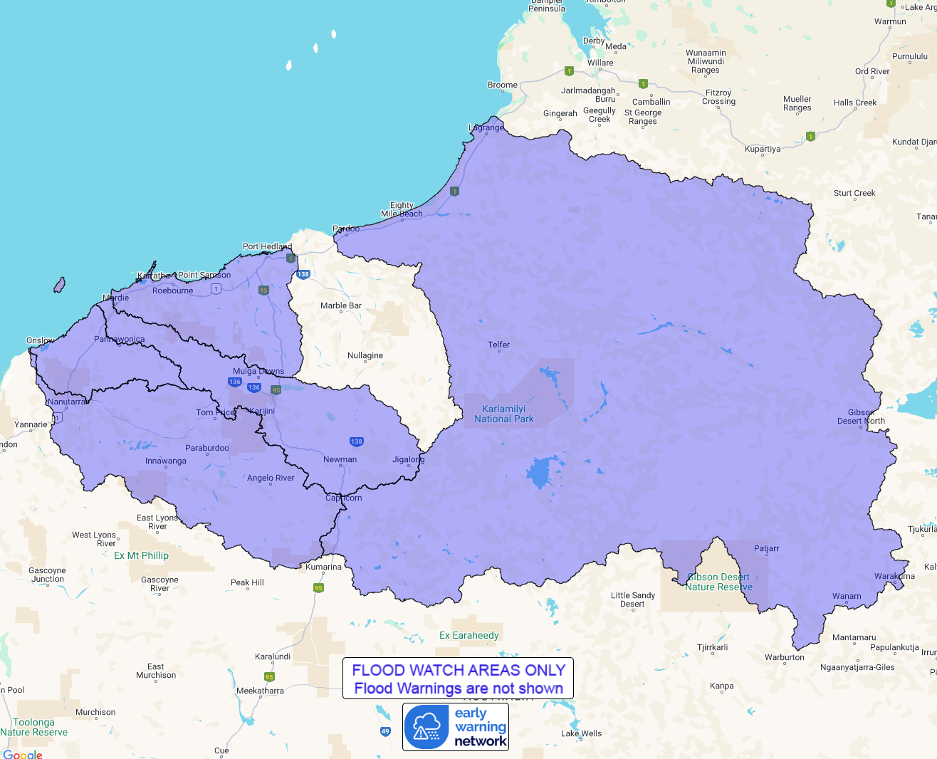
Flood Watch Number: 5
FLOODING POSSIBLE FOR THE PILBARA COASTAL RIVERS, ONSLOW COAST,
FORTESCUE RIVER, ASHBURTON RIVER AND PARTS OF SANDY DESERT FROM
THURSDAY
A broad low pressure trough over the central Pilbara extends to
Tropical Cyclone Zelia offshore from the west Kimberley coast.
Tropical Cyclone Zelia is forecast to move to the southwest
throughout today. The system is then forecast to move further south
towards the Pilbara coast on Thursday, while strengthening
further.
A Tropical Cyclone Advice is current for parts of the Pilbara and
Kimberley coast.
Catchments across the Flood Watch area, particularly towards the
coast, have become wet with recent rainfall.
Widespread heavy to intense rainfall is forecast for the Flood
Watch area from Wednesday and into the weekend. Areas of heavy
rainfall will be dependent of the track of Tropical Cyclone
Zelia.
Forecast rainfall in the Flood Watch area is expected to result in
river rises, areas of flooding and may adversely affect road
conditions and some communities may become isolated. Significant
disruption of transportation network and extensive road closures
are possible.
Catchments likely to be affected include:
Pilbara Coastal Rivers
Fortescue River
Onslow Coast
Ashburton River
Sandy Desert
A Flood Warning is current for the De Grey River Catchment.
This flood watch is available by dialling 1300 659 213. For more
information on the Flood Watch Service visit
http://www.bom.gov.au/water/floods/floodWarningServices.shtml
Flood Safety Advice:
DFES advises people and communities to be aware that flooding is
possible and be prepared to relocate equipment and livestock. Watch
water levels. Travellers need to be aware that road conditions may
be adversely affected and travel plans may need to be reconsidered.
Do not drive into water of unknown depth and velocity.
Community information is available from DFES at
www.emergency.wa.gov.au/
Current river levels are available from Department of Water and
Environmental Regulation at
www.water.wa.gov.au/maps-and-data/monitoring/river-level-monitoring
Rainfall and River
Conditions Map
12/Feb/2025 05:28 AM


