
Source: Bureau of Meteorology
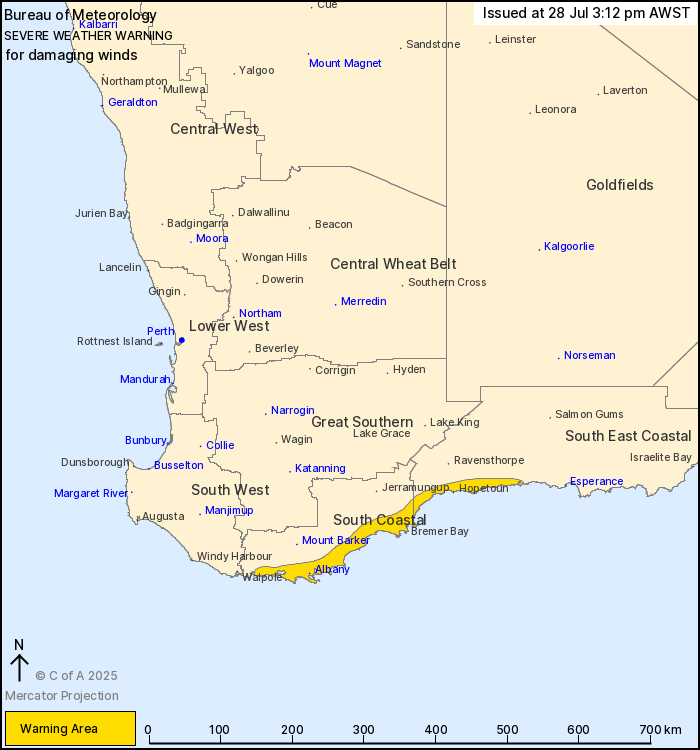
For people in parts of South Coastal and South East Coastal
districts.
Issued at 3:12 pm Monday, 28 July 2025.
Damaging winds developing along parts of the southern coast this
afternoon and into the evening.
Weather Situation: A low pressure system over the Southern Ocean
will move north towards southern parts of the WA coast. Westerly
winds aloft increasing on the northern flank of the low will bring
damaging winds to exposed parts of the South and South East Coastal
districts this afternoon, with winds easing and tending more
southerly later this evening as the low weaken and makes
landfall.
DAMAGING SOUTHWESTERLY to WESTERLY WINDS averaging 55 to 65 km/h
with peak gusts of around 100 km/h are forecast to develop from
this afternoon over the warning area and may cause DAMAGE TO HOMES
AND PROPERTY.
Winds are expected to ease late this evening.
Locations which may be affected include Albany, Bremer Bay,
Hopetoun and Denmark.
The Department of Fire and Emergency Services advises that people
should:
* If outside find safe shelter away from trees, power lines, storm
water drains and streams.
* Close your curtains and blinds, and stay inside away from
windows.
* Unplug electrical appliances and do not use land line telephones
if there is lightning.
* If boating, swimming or surfing leave the water.
* Be alert and watch for hazards on the road such as fallen power
lines and loose debris.
* Keep away from flooded drains, rivers, streams and
waterways.
* Be careful of fallen trees, damaged buildings and debris.
* Be careful of fallen power lines. They are dangerous and should
always be treated as live.
* Assess your home, car and property for damage.
* If damage has occurred take photos and contact your insurance
company to organise permanent repairs.
* If your home or property has significant damage, like a badly
damaged roof or flooding, call the SES on 132 500.
28/Jul/2025 07:26 AM


