
Source: Bureau of Meteorology
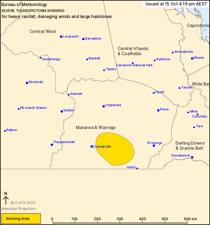
For people in parts of Maranoa and Warrego Forecast
District.
Issued at 4:19 pm Wednesday, 15 October 2025.
Severe thunderstorms across parts of inland Queensland this
afternoon and evening.
Weather Situation: A moist airmass combines with a trough in
southern Queensland to generate slow-moving thunderstorms and
associated heavy rainfall. Some thunderstorms may have damaging
wind gusts and large hail, too.
Severe thunderstorms are likely to produce heavy rainfall that may
lead to flash flooding, damaging winds and large hailstones in the
warning area over the next several hours. Damaging winds and large
hailstones are also possible. Locations which may be affected
include Bollon.
Severe thunderstorms are no longer occurring in the Channel
Country district and the warning for this district is
CANCELLED.
Emergency services advise people to:
* Park your car undercover away from trees.
* Close doors and windows.
* Keep asthma medications close by. Storms and wind can trigger
asthma attacks.
* Charge mobile phones and power banks in case the power goes
out.
* Put your pets somewhere safe and make sure they can be
identified in case they get lost.
* Do not drive now unless you have to because conditions are
dangerous.
* Tell friends, family and neighbours in the area.
* Go inside a strong building now. Stay inside until the storm has
passed.
15/Oct/2025 06:24 AM


